Inside the birch woodland
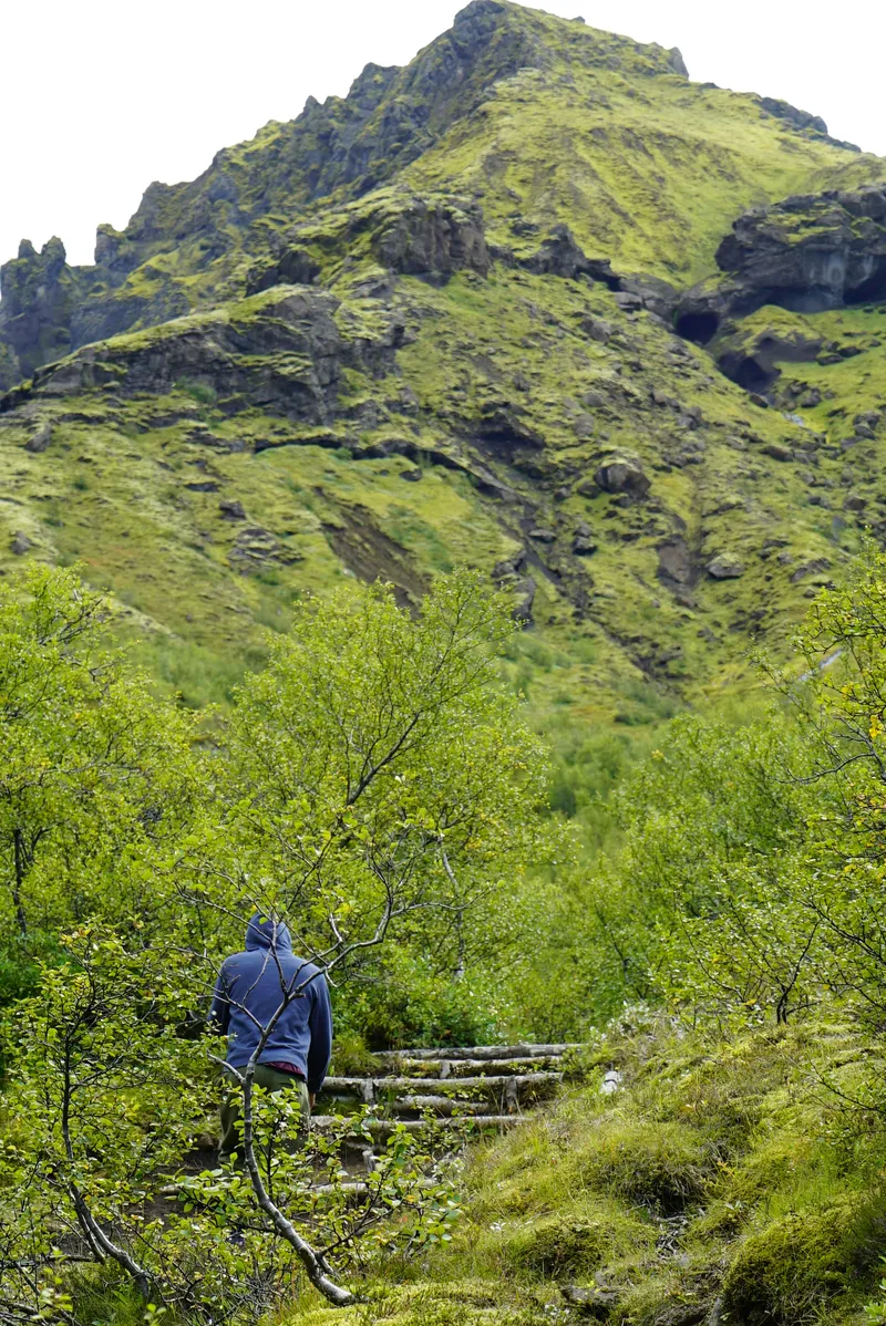
Marked paths run between trees and small clearings, with views opening along the way. Lower routes offer a way into the valley without committing to a summit, though they can still have roots, steps and steep sections.

The paths in Þórsmörk move between birch trees, gullies and ridges above a braided river plain. A short woodland walk and a long mountain circuit begin in the same valley but make very different days.
The first decision is your starting point: Húsadalur, Langidalur or Básar. From there, the walk and return transport need to fit together. F249's river crossings make the journey a specialist part of the visit.
Before you make plans
Húsadalur, Langidalur and Básar have different trail connections
Specialist access; an ordinary 4×4 is not enough by itself
Match the route to the group and the booked return
Check transport dates and current conditions before committing
Woodland, rivers and ridges
Birch woodland gives way to gullies and open ridges above Þórsmörk's river plain. Valahnúkur offers a relatively short climb for the view; the Tindfjöll circuit spends longer among the slopes. Lower marked paths keep you within the wooded valley.
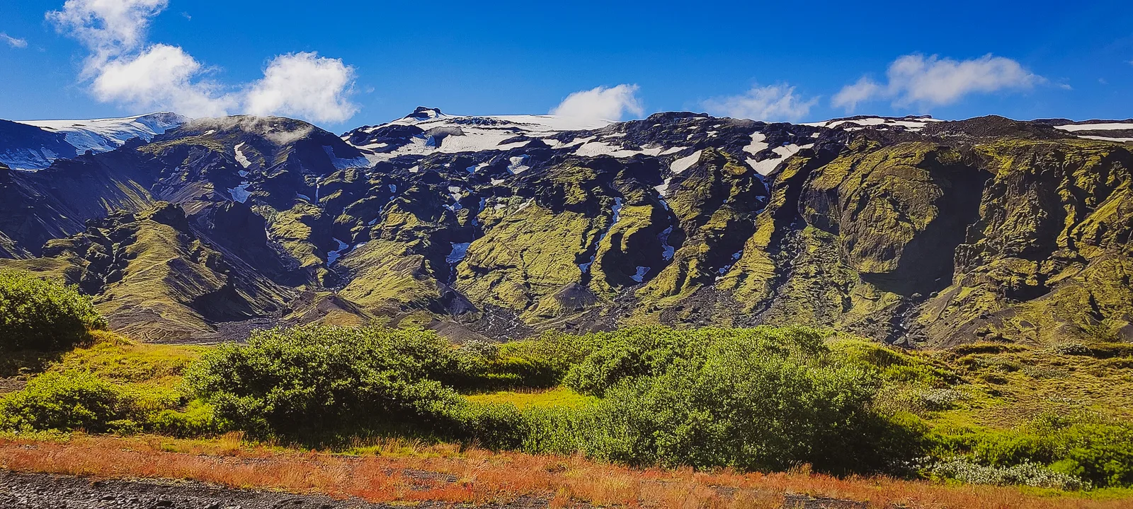
Marked paths run between trees and small clearings, with views opening along the way. Lower routes offer a way into the valley without committing to a summit, though they can still have roots, steps and steep sections.
From above, braided channels reveal the scale of the valley. At ground level, that same water shapes the journey and separates useful starting points. Enjoy it from established paths and viewpoints; a line on a map is not proof that you can cross from one bank to another.
Valahnúkur and the Tindfjöll circuit reveal more of the mountains and river channels. Both require comfort on steep ground. Low cloud can hide the view while leaving the woodland worth exploring below.
North of Krossá
South of Krossá
Know your starting point
The stop on your booking determines where your walk begins and ends. Confirm any transfer or pedestrian crossing before planning a route between bases.
Schematic only. No bridge or connecting trail is implied.Get to the right starting point
The approach is part of the planning. F249 includes unbridged rivers, and conditions affect both the outward journey and the return. A road marked open does not make every vehicle or crossing suitable.
Húsadalur, Langidalur and Básar are separate transport stops. The base on your ticket determines where the walking day starts and ends.
A useful choice when you want river access, route selection and the return journey coordinated by a local operator.
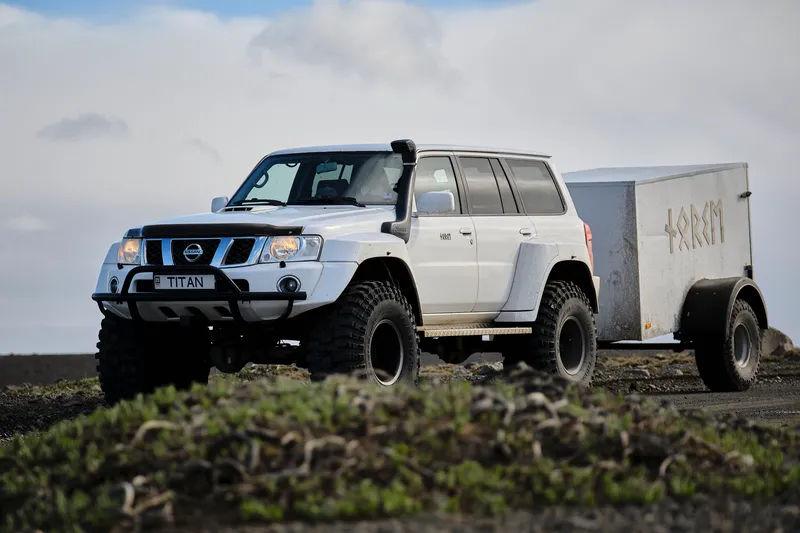
A specialist vehicle and an experienced driver can open up suitable options, but the day's route still depends on conditions. Confirm whether the trip centres on walking, sightseeing stops or a mixture; similar tour names can describe very different days.
Ask for the intended base, realistic walking time, vehicle arrangements and the alternative plan if access changes. Share fitness, mobility needs and comfort on exposed paths before booking.
Well suited to independent walkers who want the road journey organised and can work within a booked return window.
Specialist services connect the south with named stops in the valley. Operators differ: do not assume every ticket serves Húsadalur, Langidalur and Básar. Check the timetable for your travel year and date, including where any connection takes place.
Book the outward and return legs, save the exact stop names and calculate time on the ground. Confirm the boarding point locally before walking away. A later bus shown on another date is not a fallback for your booking.
An option only when the vehicle, rental permission, driver's river experience and current conditions all support the specific route.
An ordinary rental 4×4 is not automatically suitable for F249. Krossá is a particularly serious obstacle on the approach to Langidalur and Húsadalur; Volcano Huts advises visitors against crossing it in a regular 4×4. Básar avoids that river crossing but still involves other fords.
Discuss the exact route with the rental company and local operators, and read river-damage exclusions. Never use another vehicle's successful crossing as your assessment. If the access is uncertain, choose arranged transport or change the day.
Húsadalur is home to Volcano Huts; Langidalur has FÍ's Skagfjörðsskáli; Básar is Útivist's base in Goðaland, south of Krossá. Match the trail description to the base on your ticket. A route measured from Langidalur needs extra walking if you begin elsewhere.
Ask about any required pedestrian crossing and its current position before planning a walk between bases. Never improvise a ford across Krossá. Volcano Huts explicitly says it does not provide a shuttle across the river, so arriving at the opposite bank without onward arrangements is not a transport plan.
From Reykjavík, allow a full day and compare actual time in the valley before choosing a ticket or tour. Starting on the South Coast may shorten your journey, but it does not automatically lengthen a scheduled bus's hiking window. Keep the return stop central to your route choice.

Four ways to spend time on foot
The routes progress from lower woodland paths to demanding mountain walking. Figures refer to the linked route from its stated base; similarly named loops can be longer. Walking estimates exclude breaks, and ascent is described qualitatively where no clear cumulative figure is published.
Woodland paths, a summit or a longer circuit
A flexible first visit
Ask the warden or reception for a short marked walk from your arrival base. This approach lets you explore birch woodland and valley views without committing to a summit or a loop whose far side is unfamiliar.
Between the buses
Work from the hours between arrival and your booked return. A lower walk and picnic fit a shorter visit; a circuit uses most of the valley time. If nearly all the day would be spent travelling, a closer South Coast walk may be a better fit.
For a mixed group that wants woodland, scenery and time to sit outside.
Locate the return stop, then ask which lower marked paths suit the group that day. An out-and-back gives you a straightforward turnaround.
Bring a picnic or arrange a meal at the base. Put on an extra layer when you stop, and finish near the departure point before boarding.
You may miss a summit panorama, but the pace gives everyone more room to enjoy the valley.
For walkers who want to spend most of their valley time on a suitable trail.
Compare the exact route from your arrival base with the walking window. Ask about difficult sections and route changes locally before starting.
Count lunch, photographs and slower sections in the day's timing. Rjúpnafell needs a separate plan. Finish at the booked base with time for water, facilities and boarding.
A longer circuit takes most of the visit. Choose it because you want that walk, not to collect more locations.
Comfort and confidence on the trail
Sheltered woodland and an exposed ridge can feel like different seasons on the same walk. Carry layers, lunch, water and navigation; tell someone your route and expected return time before leaving the base.
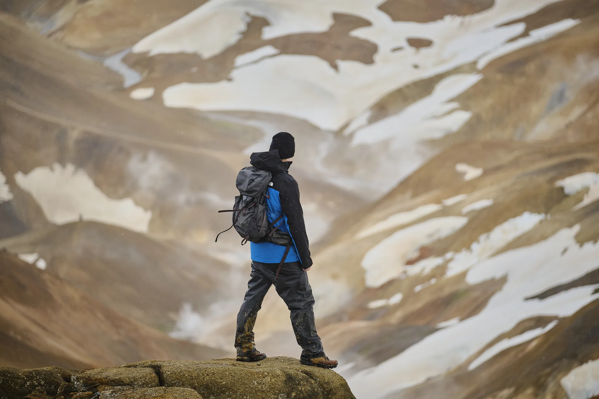
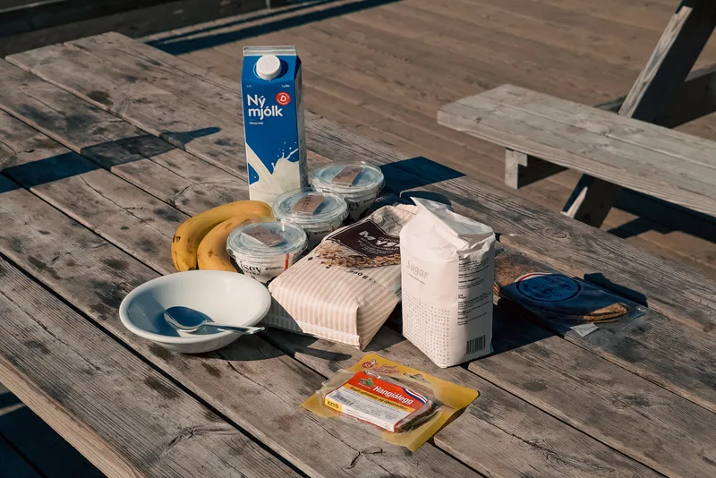
Wear a wool or synthetic base, an insulating mid-layer and a windproof, waterproof shell. Bring a hat, gloves, warm socks and footwear with reliable grip. Carry a spare warm layer for stops and keep it dry inside the pack. Sheltered sunshine at the base says little about comfort higher up.
Bring enough food and drinking water for the route plus a delay. Refill at your base before leaving and ask staff about suitable water points. Húsadalur has catering, but confirm opening and meal arrangements; do not plan a tight return around an unbooked meal or assume each hut has a restaurant.
Toilets and other services are concentrated around the huts and campsites. Day visitors may need to pay a facility fee; follow the local instructions. A hut's presence on a map does not mean its kitchen, shop or indoor space is available to everyone. Check before relying on a service.
Mud, loose slopes, snow and wind can change the effort involved. Keep navigation available offline and know the route beyond a single phone screenshot. Carry a charged phone and a small first-aid kit; reception varies. If the chosen route looks unsuitable, ask for a shorter option rather than pressing on.
Follow marked routes, respect closures and avoid shortcuts through vegetation. Bring all rubbish back, including food scraps. Use designated facilities and camping areas, and keep vehicles on permitted roads and tracks. A photograph is easy to take from the path; damaged ground can take much longer to recover.
Let conditions shape the visit
Summer brings the broadest range of scheduled transport and staffed bases. Spring thaw, autumn service closures and winter snow affect access differently; transport dates and local trail conditions matter alongside the month.
Leafy woodland and long days make this the most straightforward season for a first hiking visit. July and August are popular walking months.
Seasonal buses and staffed bases provide more options, but check the actual dates and stop pattern. River conditions can still interrupt access in summer.
Choose a route suited to the group and keep weather layers in the pack. Long daylight gives flexibility on foot; it does not extend a booked bus departure.
Spring brings changing ground conditions; autumn can bring warm leaf colours and quieter-feeling woodland. Neither supplies a fixed start or end date for hiking.
Road opening, bus operation and hut staffing follow different calendars. Spring thaw can limit access, and late-season services may already have ended.
Ask about lingering snow, mud and daylight before choosing a ridge or circuit. Keep a lower alternative, and confirm access first when planning specifically for autumn colour.
Snow and bare woodland give the valley a different character, with much shorter days and a more demanding journey.
Treat a winter visit as a specialist arranged outing, subject to conditions. Summer buses and hut services cannot be assumed; FÍ's Langidalur hut is normally closed and locked.
Agree a realistic outdoor plan with the operator for that day. Summer distances and walking times are not winter estimates, and a summit or longer circuit may be inappropriate.
Good to know
Do not assume so. F249 involves unbridged rivers, and suitability depends on the exact vehicle, rental permission, driver experience and current conditions. The Krossá crossing towards Langidalur and Húsadalur is particularly serious. For most visitors, a specialist guided vehicle or seasonal Highland bus is the more practical arrangement.
Choose around your walk and transport. Húsadalur has Volcano Huts and its local walking network; Langidalur is the starting point for FÍ's published Tindfjöll circuit; Básar is in Goðaland, south of Krossá. They are separate stops. Confirm any connection on foot rather than assuming a river crossing or shuttle is available.
It can be when the group is comfortable with steep sections and conditions are suitable. FÍ gives about 4 km and 1–2 hours for its overview route; the exact loop depends on your base. Add time for breaks, the descent and getting back to the booked departure point.
Compare the exact timetable and starting point. FÍ's 7.6 km Langidalur circuit takes an estimated 3–4 hours before breaks; the Húsadalur version is longer. Rjúpnafell is a very challenging 6–7-hour hiking objective, so plan it separately with sufficient time and suitable transport or a local overnight stay.
Yes. Ask for a short marked woodland or valley walk from your arrival base, with a clear turnaround. Tell the operator about the group's needs before booking, since uneven ground and steps still matter. Compare the time spent travelling with the time you will have to enjoy the valley.
A visit may be possible with suitable specialist arrangements, but access, bus dates, staffing and walking conditions change separately. Spring thaw, snow, weather and short daylight can alter the plan. Confirm the actual date with the operator and keep a different day-trip option available if the valley cannot be reached.
Keep exploring
Use local access judgment
Newsletter
New departures, field notes from Iceland, and practical planning ideas from the Norse Adventures team.