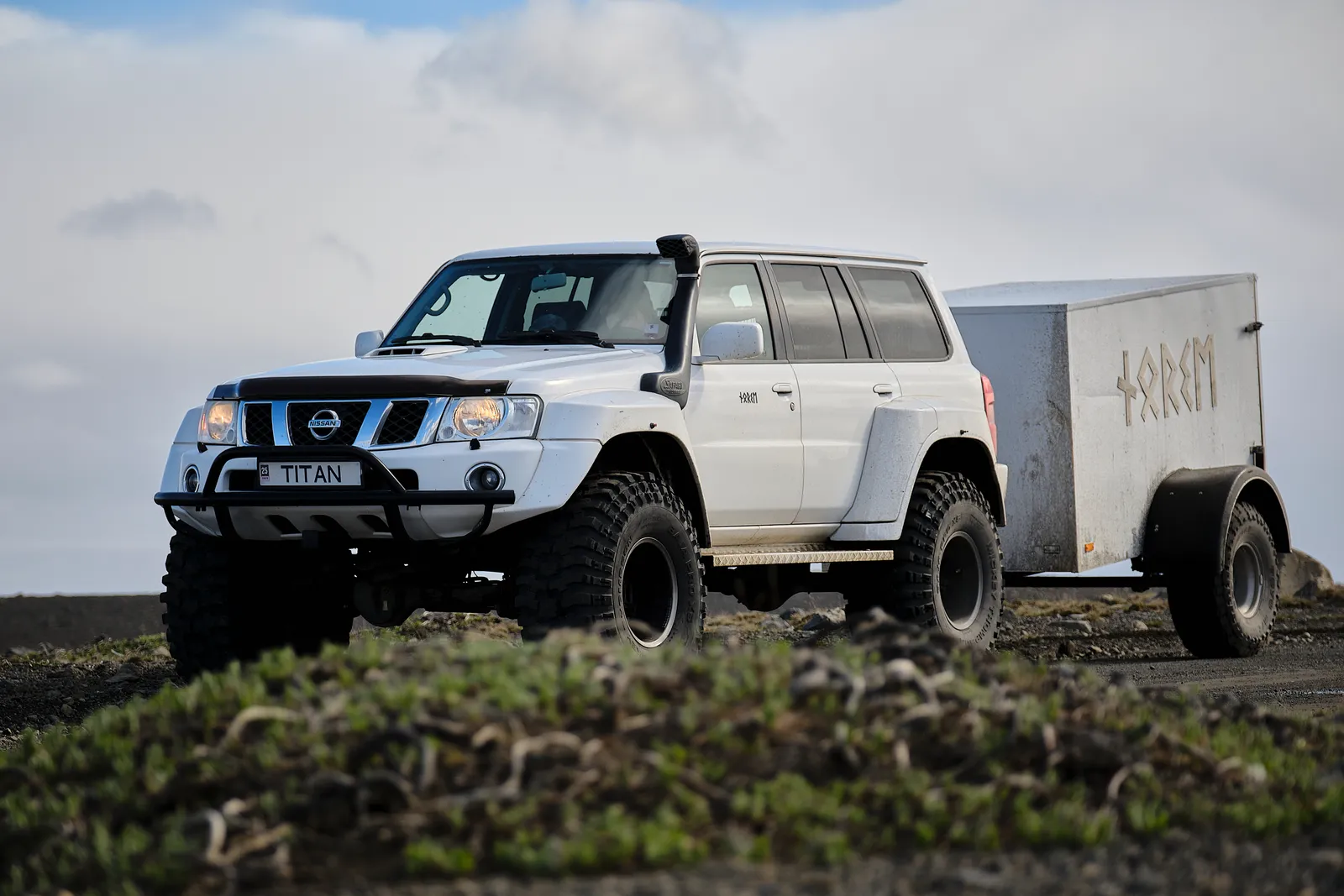
Norse Adventures modified Nissan Patrol and luggage trailer on a Highland track

Highland safety guide

F-Roads and Highland Roads in Iceland

Start reading

A Highland destination can have several approaches with very different road surfaces, vehicle requirements and river crossings. This reference compares the actual roads, then the access reports, rental questions and transport alternatives that matter before departure.

Read the road

Road numbers and surfaces

Start with road numbers, including the final access spur and return journey. A destination can have several approaches; the shortest one on a navigation app may be the most demanding.

Paved main roads

A paved approach can connect towns and major sights before the surface or road category changes. The first smooth kilometres do not describe the road beyond the next junction.

Check the point where your route leaves the main road. Slow down before a change to gravel, allow more following distance and use proper stopping places for photographs.
Highland roads without an F

Road 35 through Kjölur and road 550 through Kaldidalur are useful reminders that Highland travel is broader than the F-road label. Seasonal access, rough surfaces and rental restrictions still matter.

Look up the road by number and check its conditions and contract restrictions. A missing F does not turn it into an ordinary all-season shortcut or establish permission for a two-wheel-drive rental.

F-roads

The Road Administration uses the mountain-road category for particularly rough, uneven or steep roads and roads with unbridged rivers. Different F-roads can make very different demands on a vehicle.

Use a suitably capable, specifically permitted vehicle and check the obstacles on every segment. Stay on the designated road: an F-road is a road, while driving away from it is off-road driving, which is prohibited.

Choose the approach

Highland route reference

These five approaches differ in road surface, vehicle demands and river crossings. Use the route number when checking the live road report and your rental agreement.

35

Kjölur / Kjalvegur

Open central Highland country on the route north of Gullfoss towards Hveravellir and the north of Iceland.

Access and vehicle
Check the complete section you intend to drive, including any side road to accommodation or a trailhead. A visit from the south and a full crossing are different commitments.
River crossings
The Environment Agency's Hveravellir guidance says the rivers on main road 35 are bridged or culverted. That does not describe every road branching from it.

The road's missing F prefix does not remove seasonal restrictions or your rental conditions. Leave time for rough sections and stops instead of treating the interior crossing as a quick link between regions.

Route advice for Kjölur / Kjalvegur
550

Kaldidalur

A gravel mountain route linking the area north of Þingvellir with the Húsafell side of West Iceland, through open country beside glacier landscapes.

Access and vehicle
Confirm opening, surface conditions and vehicle permission for road 550 itself. Check separately any added glacier access road or connecting mountain track.
River crossings
The main road has no routine river fords. Its rough surface, exposure and seasonal conditions still need attention; a nearby route can have different obstacles.

A route that looks like a neat connection on a map may use more time and concentration than the lowland alternative. Keep a paved-road plan available if conditions or confidence do not fit.

Route advice for Kaldidalur
208 / F224

Landmannalaugar from the north

The Sigalda approach, often called F208 north in visitor information, followed by the short F224 spur towards the hut area.

Access and vehicle
FÍ identifies the northern Sigalda approach as having no unbridged rivers. Keep it distinct from the southern F208 and the western F225 approaches when reviewing a navigation route.
River crossings
The final F224 spur has two fords near Landmannalaugar. Parka identifies P1 before those rivers, with a pedestrian bridge for the walk to the main area.

Parking at P1 avoids those final vehicle crossings. Check the current parking reservation rules, allow time to walk from the car and confirm conditions on both 208 and F224.

Route advice for Landmannalaugar from the north
F208

The southern Fjallabak approach

Mountain country reached from the Skaftártunga side, with access towards Eldgjá and onward through Fjallabak.

Access and vehicle
This is a separate approach from northern 208. Research the exact stretch, vehicle requirements and turnaround options; advice for the northern approach cannot be transferred to the southern route.
River crossings
Unbridged water is part of the planning. Vatnajökull National Park identifies Strangakvísl on the access to Eldgjá; any onward journey needs its own current road and river assessment.

A sightseeing stop at Eldgjá does not establish that the remaining road to Landmannalaugar is suitable. Ask the park's rangers about the section you actually intend to use.

Route advice for The southern Fjallabak approach
F249

Þórsmörk

A river-valley approach where the chosen base matters: Húsadalur, Langidalur and Básar are different destinations.

Access and vehicle
For visitors without relevant river-driving experience, arrange a Highland bus or guided transfer. Confirm the exact drop-off and collection point before booking walks or accommodation.
River crossings
F249 includes several unbridged rivers. Krossá is a major additional obstacle for reaching Húsadalur and Langidalur. Reaching Básar avoids Krossá but still involves other fords.

Volcano Huts advises visitors against driving their 4x4 across Krossá. A large vehicle ahead is not a suitable test for your rental car, and a footbridge should not be assumed available as a backup.

Route advice for Þórsmörk
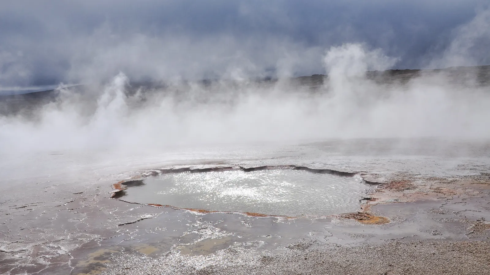
Steam rising above a hot pool surrounded by pale mineral deposits at Hveravellir
The geothermal landscape at Hveravellir. Choose the exact approach roads as carefully as the place you want to reach.

Opening & conditions

Road opening, forecast and vehicle

Seasonal opening dates describe access beginning. The current road report and forecast decide whether the planned journey is suitable today.

Thawing ground decides the opening

Snow cover and the condition of thawing ground determine when mountain roads can take traffic. In protected areas, the surrounding land also needs to withstand visitors. A track that looks clear may still be vulnerable to lasting damage.

Historical dates help you plan a season

The Road Administration publishes previous opening dates and a mountain-road opening map. Use these to understand variation between roads and years. An average date is not a reservation for access, and one open section does not open the whole route.

Current reports shape the day's decision

Read Umferðin's current status and notifications for each segment, then the weather forecast and SafeTravel alerts. Check before departure and again as the day develops. Wind, rain, snow or damage can change a route after the summer opening.

A closure means change the plan

Respect closure signs and barriers even when another vehicle continues. Do not drive around a blockage or snow patch onto surrounding ground. A modified vehicle or a tour booking does not override an official closure; confirm lawful access with the operator.

The vehicle and rental agreement

Agree the entire route with the rental company and confirm the vehicle supplied matches that agreement. The labels SUV and 4WD alone do not settle suitability.

Confirm the exact vehicle

Ask whether the actual model and configuration are appropriate for every proposed road. Ground clearance, tyres and vehicle size matter alongside driven wheels. SafeTravel explicitly distinguishes routes suitable for smaller 4WDs, larger vehicles and modified mountain vehicles.

Get permission for the road numbers

Read the contract and ask the supplier about the complete route. For example, Hertz's terms explicitly restrict roads 35, 550 and 208 as well as F-roads to approved vehicles. That is one supplier's policy; your agreement must be checked separately.

Understand damage and assistance terms

Ask which damage, recovery and towing costs are excluded, particularly water, underbody and tyre damage. A reassuring insurance package name is not enough: obtain the actual wording. Road permission, vehicle capability and insurance cover are three separate questions.

Check the equipment before leaving

Inspect tyres and understand the supplied spare or repair kit and assistance procedure. Know the vehicle's controls before reaching difficult ground. Tell the supplier how you plan to travel and resolve mismatches before the journey, while changing the plan is straightforward.

At the river

Unbridged rivers

A ford takes the road through water without a bridge. SafeTravel warns that damage during river crossings is not insured; read your own rental exclusions and stay out of the water when uncertain.

123
Water changes along the whole catchment. Illustration only; it cannot show whether a crossing is passable.

Rain upstream

Rain can increase flow in the river's catchment even when the weather at the ford looks manageable. Yesterday's photograph or a report from earlier in the day may no longer describe the crossing.

Snow and glacier melt

Meltwater contributes to glacial rivers, and flow can vary through the day. Sunshine is not proof of low water. A fixed depth quoted in a travel guide cannot establish the conditions you will find.

The journey back

A successful outward crossing does not secure your return. Plan for changing water and enough time to stop or turn back without pressure from a restaurant booking, accommodation deadline or flight.

Keep uncertainty out of the water

If your experience, vehicle permission or assessment is insufficient, do not enter. The vehicle is not a tool for testing a ford. Another driver's crossing does not resolve those questions for your own party.

Choose an alternative with known access

Turn back to a suitable stopping place and reconsider the day. An alternative road needs the same research as the original. Where available, a booked bus or guided transfer can let you reach the destination with experienced transport.

Ask locally before committing

Wardens, rangers and operators can explain recent conditions and the practical options. Ask about the return as well as the outward journey. Advice supplements current observation and official restrictions; it cannot guarantee how a river will behave later.

Build your day

Buses, guides and independent travel

A seasonal bus or guided vehicle can take care of the approach while you focus on walking. Compare the exact arrival base, time to explore and return arrangement.

Drive yourself

You choose the stops and pace, and take responsibility for the route, vehicle and changing conditions.

Arrange
A suitable permitted vehicle, any parking or overnight reservations, current road information and a complete return plan. Build in stops where passengers can enjoy the landscape without distracting the driver.
Limits
The plan must fit your actual experience. A rental booking does not provide river-driving judgment, and open roads can still be unsuitable for your vehicle.

For drivers who can assess the chosen route realistically and are willing to turn back or switch to a different day.

Take a Highland bus

A seasonal transport service handles the journey to a specific Highland stop, leaving you to organise your time there.

Arrange
Book the outward and return services, check operating dates and choose the exact stop. Compare the time between arrival and departure with your walk, meals and a return margin.
Limits
A transport ticket does not automatically include a hiking guide. Timetables and accessible destinations depend on the operator, season and conditions; verify the service you intend to use.

For independent walkers who want scheduled access to places such as Landmannalaugar or Þórsmörk without making the Highland drive themselves.

Go with a guide

A guided outing combines suitable transport with local planning and the agreed activities at the destination.

Arrange
Confirm the route, vehicle, walking expectations, pickup, inclusions and the weather alternative. Explain your group's interests and abilities so the road journey and time on foot work together.
Limits
A guide still works within road restrictions and conditions. Ask how an altered route is handled instead of treating the advertised destination as guaranteed in every forecast.

For visitors who want help choosing the day, interpreting the landscape and adapting the plan as conditions develop.

Before departure

Time for the road and the return

Allow for slow gravel driving, breaks, parking and walking. Set a realistic turnaround point before starting. A mapping estimate is not a promise, and fatigue matters just as much on the last paved stretch home.

Fuel, food and warm layers

Confirm available services and carry enough fuel or charge for the planned journey with a sensible margin. Bring water, food, medication and warm waterproof clothing. Do not rely on an unconfirmed café, charging point or petrol station deep in the Highlands.

Maps and a contact plan

Save the route, confirmations and useful contacts offline, and bring backup power. Tell someone outside the group your route, alternatives and expected return; use SafeTravel's travel-plan service and agree how changes or an overdue return will be handled.

Good to know

Common questions

Are F-roads the same as off-road driving?

No. F-roads are designated mountain roads. Leaving the road to bypass an obstacle, cut across open ground or reach a photo spot is off-road driving. Stay on the road and use designated stopping places; do not follow tyre tracks across the landscape as evidence of permission.

When do Iceland's F-roads open?

There is no single opening date. Snow, thawing ground and protection of the surrounding area affect each route. Historical opening dates help with planning, but the current mountain-road map, Umferðin reports and local restrictions determine whether a specific journey can be considered. Check again near departure.

Does a 4WD rental let me drive every Highland road?

No. The exact vehicle must be suitable and the rental agreement must allow the road. Some roads require greater clearance or specialist vehicles; suppliers can also restrict roads without an F prefix. Send the rental company your intended road numbers and get a clear answer before booking.

Can I reach Landmannalaugar without driving through a river?

In suitable conditions, the northern approach via 208 reaches F224 without unbridged rivers. The final F224 spur has two fords, but you can stop at P1 before them and use the pedestrian bridge. Confirm current access, vehicle permission and parking requirements; this advice does not describe southern F208 or F225.

Does insurance cover driving through a river?

SafeTravel warns that vehicle damage during river crossings is not insured. Do not assume a premium package changes that warning. Read your own agreement and ask the supplier specifically about river damage, recovery, towing and prohibited roads. Even permission to use a road does not establish cover for every incident.

Can I visit the Highlands without renting a 4WD?

Yes, where seasonal transport or a suitable guided outing is operating. Highland buses serve places including Landmannalaugar and Þórsmörk; check the actual dates, stops and return timetable. A guided trip can combine transport and walking. Either option still depends on road conditions and official restrictions.

Highland plans need judgment

Explore Highland routes where access is part of the planning

Browse Highland Tours
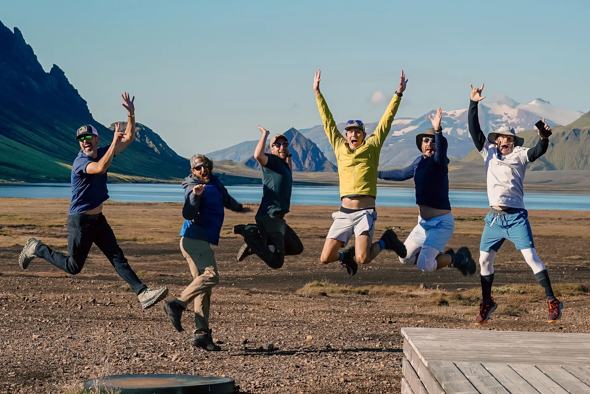
Happy group of hikers outside Alftavatn Hut in Iceland with Norse Adventures

Newsletter

Join our community

New departures, field notes from Iceland, and practical planning ideas from the Norse Adventures team.